JpgInfo
Simple tool to view jpg-files in Google Earth and more ..
Background
You have lots of geocoded photos (from your mobile etc) and wants to view these on a map. This simple tool installs into the context menu (right click). Right click the root folder and choose Jpginfo KML. Click on the _jpginfo.kml file to view the photos in Google EarthDone.
Jpginfo.exe
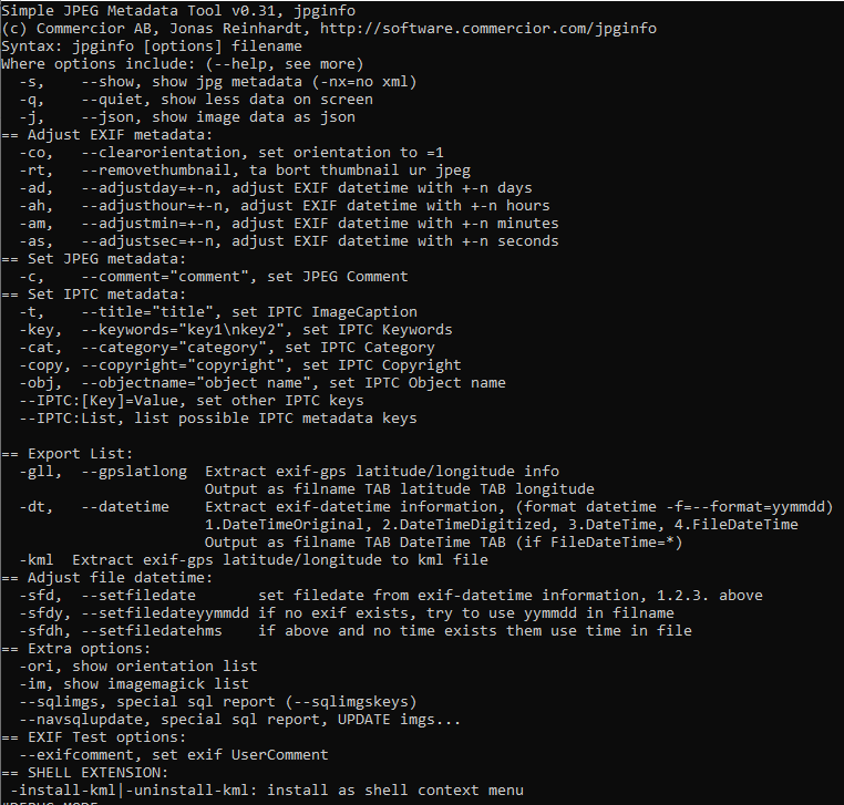
This simple tool has a lot of options, but this guide will describe how to use the view by Google Earth option
Download / Install
 get JpgInfo
JpgInfo.zip
- Extract the JpgInfo.exe and place it in a folder ..
- from a command line run
jpginfo -install-kml: this will try to install a context-menu(right-click) handler with the name JpgInfo KML - (uninstall by
jpginfo -uninstall-kml)
Use
- Right-click on the folder with geocoded jpg photos
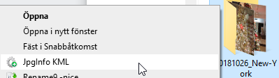
- Choos JpgInfo KML
- In the folder there is now a file named
_jpginfo.kml, click to view the photos in Google Earth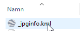
Version / History
- 2020-may-08
- new option for the Google Earth viewer
- older
- many versions for the options not described here
More info
More info/questions from: Subject: JpgInfo
Keywords:jpg,jpeg,image,information,extraction,google earth,kml